agriculture

Complex Agroforestry and the Built-Environment

Note: This is a portion of an essay I wrote a number of years ago (in 2007) and is best read in conjunction with two additional articles I have posted on this site: Chinampa: Raised-Bed Hydrological Agriculture  and  The Domesticated Landscapes of Los Llanos de Moxos, Bolivia.

Complex Agroforestry and the Built Environment

By Spencer Woodard

2006 – 2007

Agroforestry is currently receiving considerable attention as a stable and ecologically viable form of tropical forest land use (Alcorn, 1984; Budowski, 1981; Hart; 1988; King & Chandler, 1978; Salas, 1979; Spureon, 1980; Weaver, 1979; Denevan, 1987). Traditional forest farming techniques provide us with one of the most logical and effective models of intelligent land management. Recent studies have demonstrated that some of the most successful food-producing adaptations to rainforest environments have been those of indigenous people (Erickson 2005; Heckenberger et al 2007; McNeely 2004; Miller & Nair 2006). These complex systems were developed and refined over thousands of years and, although now in peril of destruction and disappearance, they can still provide us with insight into how we can properly and sustainably manage our soils, water, crops, animals, pests and so forth (Thrupp 1998; Altieri 1999; McNeely 2004). In order to properly go about studying these historical systems we must understand their features through a variety of disciplines. Furthermore, we must begin to put information into practice that is extracted through experimentation and field research.


Historically conservationists have focused their attention on protecting ‘natural’ forests, these include landscapes which are understood as existing in a ‘pristine,’ ‘virgin,’ or ‘primary,’ state and deemed as such based on the idea that they have suffered from little or no direct human impact. However, there exists a rapidly accumulating body of evidence to support the view that very few of today’s forests, anywhere on earth, can be considered to truly exist in such a state (McNeely 2004). Not only do studies suggest that large portions of the neo-tropical forest landscapes of the Americas are anthropogenic, but that biodiversity in these anthropogenic areas is now equal to if not higher than areas which were not inhabited by large pre-Colombian societies (Erickson 2005; Atta-Krah et al. 2004; McNeely 2004).

Western society has fabricated a romantic, mythical vision of the untouched wilderness and the dominant conceptions of pre-Colombian native peoples that dwelled within these environments – small, idealized populations of semi-nomadic humans whose impact on the earth’s landscape was invisible or non existent. Despite the many misconceptions, there exists more than ample irrefutable evidence demonstrating how, up until the end of the fifteenth century, the Americas supported dense human populations which substantially altered the forest and topography in ways that proved beneficial to both human and non human life-forms (Heckenberger et al. 2003; McNeely 2004; Denevan 1967, 1992, 2001; Erickson 2005). McNeely argues that “the Western vision of an untouched wilderness has permeated global policies and politics in resource management. This view of forests is based on an outmoded ecological perspective, and on misunderstanding of the historical relationship between people and forests, and the role people have played in maintaining biodiversity in forested habitats.” It is important that modern peoples begin to understand that much of the older vegetation throughout the world is the legacy of past civilizations; managed agroforests that were abandoned hundreds of years ago during various waves an periods of colonial onslaught. Although this paper will focus on the tropics of the Americas, McNeely goes further, with examples from Asia, the western hemisphere, Europe and the Mediterranean, to demonstrate that cycles of human activity have affected biodiversity in forests worldwide (McNeely 2004: 157-160).

Perhaps one the most noteworthy reasons why early Europeans did not detect the presence of extensive, highly diversified land management and resource renewal techniques employed by native populations of the Americas was because indigenous systems were so masterfully executed; the artificiality of the built environments totally eluded the unobservant foreigners. One culture’s masterful creation was perceived merely as wild nature in dire need of “taming” to the newly arrived other. The first Spanish visitors would not have understood any other approach to land management and food production distinct from those employed in Europe at the time. So Mesoamerican Indians were seen and portrayed as hunter/gather primitives who had not yet “discovered” plant and animal domestication. In reality, as I will continue to stress throughout relevant discussion, in terms of logic, efficiency, renewability and productivity, pre–Colombian populations of the Americas practiced a refined and far superior agricultural technology which reached far beyond the faulty models that existed (and have persisted) throughout Europe at the time.

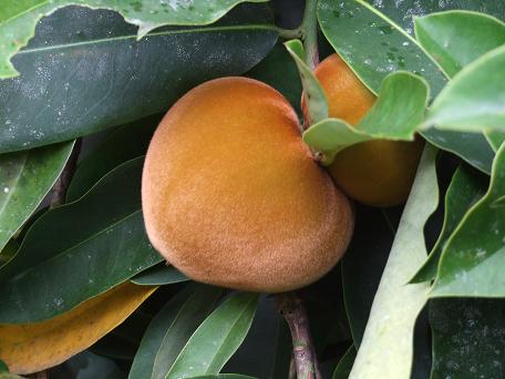
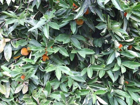
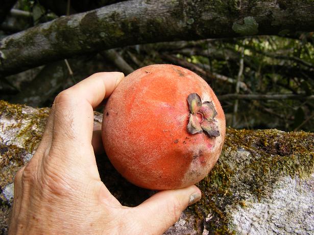
The indigenous approach operated at an altogether elevated degree of sophistication in terms of management and functionality, working towards both societal and ecological sustainability under the precept that you can’t have one without the other. Hundreds of species of edible, medicinal and other useful plants and animals existed within large tracts of built forest, all constructed, managed and harvested by local populations. In his recent book, 1491: new revelations of the Americas before Columbus, author Charles Mann recounts a conversation with anthropological botanist Charles Clement, from the Brazilian National Institute for Amazon Research. In one brief but impacting statement Clement says, “Visitors are always amazed that you can walk in the forest here and constantly pick fruit from trees, that’s because people planted them. They’re walking through old orchards” (Mann 2006, 343).

Planting, managing and harvesting their forest gardens over thousands of years the first Amazonians slowly transformed large swaths of natural forests into something more useful, something that would function as undomesticated nature had, as a stratified, self-sustained forest ecosystem, providing habitat for native flora and fauna, yet the customized forest would also provide a wealth of products necessary for human existence.

“Swidden-Fallow” agroforestry describes a traditional method of modifying and managing forest environments on a larger scale as is still widely practiced throughout the Amazonia. Balee (1994: 116-165) describes this practice of forest management as, “the manipulation of inorganic and organic components of the environment that involves direct and indirect human interferences in species populations distribution and behavior… some species may become locally extinct, but there may be an increase in the overall ecological and biological diversity.” It is worth pointing out that, due to lack of research, the highly productive method of swidden-fallow forest/food system management has seldom been commented on in the literature on shifting cultivation (Harris 1971: 482; Denevan 2001: 83).

The swidden-fallow process can be summarized as follows: A plot of forest is selected and surveyed, valuable, or desirable species occurring naturally in the area are identified and left in the area, all other undesirable species (of shrub, vine, tree, etc.) are removed. All biomass from felled vegetation is either left to slowly decompose providing nutrients and suppressing weeds, or it is burned for nutrients in the ash. Void spaces left by eliminated species are filled in with food, medicine, or other useful crops. Based on growth-rate, eventual size, and overall growth habits of the newly implemented plants and trees, plantations are made so as to mimic natural, stratified tropical forest design. Then the swidden site is left to fallow. In the time between a new planting and maturation of tree crops a swidden site can be intensively cultivated with annuals and perennials. Once young trees have developed a substantial canopy leaving the under-story with insufficient light to be cultivated with perennial crops, the site is left to mature and self-regulate while being harvested by humans on a regular basis. Thus an anthropogenic forest is created. If one is familiar with the concept of “slash and burn”, a more commonly discussed form of shifting cultivation, swidden-fallow might be understood as a similar approach, but with a greater degree of complexity and a heightened potential for longer-term, restorative agricultural.

“Fallow management involves both purposeful and unintended human manipulation of both individual plants and groups of plants, both wild and domesticated or semi-domesticated” (Denevan 2001: 84). In the first ten to twelve years a fallow is managed most actively and intensively where as older fallows require less management although they can be harvested for thirty-five years or more. It is common that old, unproductive fallow sites are remodeled and replanted to become young swidden once again, this way forests are replenished and selectively propagated, constantly maintained at their optimal productive capacity. Denevan (2001) reports that in contemporary intensive swidden systems the cropping to fallow ratio is high, one to three years of intensive cropping followed by twenty or more years of fallow. Denevan has concluded that high ratios of cropping (swidden) to fallow are probably not indicative of prehistoric methods rather, in other words, cycles of cropping and fallowing were more balanced out (Denevan, 2001: 68).  De Jong (1996) reports that farmers in the Peruvian lowland Amazon today do not continue the intensive use (cropping) of a fallow site for more than four years because of decreasing returns and increasing weed invasion make it less profitable than changing the field to a forest garden and make a new swidden elsewhere. Older fallows (forest gardens) require less human input than intensively cultivated swidden, but continue to be economically important (De Jong 1996).

One of the major reasons why the swidden-fallow method was developed by peoples living in various tropical regions around the world relates to the extremely poor condition of rainforest soils. Fallowing land after intensive cropping is one of the most basic and assured ways of restoring soil fertility; vegetation returns regenerating depleted nutrients.

Even today, out of all known domesticated plants in the Amazon, more than half are trees. (Depending on the definition of “domesticated” the figure could be as high as eighty percent). In the region inhabited by the Ka’apor, centuries of selective propagation through swidden-fallow cultivation and management have profoundly changed the forest community. Ka’apor-managed forests hold plant inventories of which almost half are used by humans for food, remaining species hold equally important value, as medicine, timber, etc. In similar forests that have not recently been managed, the figure is only 20 percent (Mann 2006: 343). Balee has estimated that at least 11.8 percent, about an eighth, of the nonflooded Amazon forest is “anthropogenic”, directly or indirectly created by humans. Many researchers today regard this figure as conservative, some will even go so far as to suggest that all neotropical forests were designed, constructed and managed over thousands of years by indigenous inhabitants. Clark Erickson maintains that  most, if not all neotripical landscapes are built environments and that the lowland tropical forests of South America are among the finest works of art on the planet (Mann: 343-344). Accordingly, Peter Stahl, an anthropologist at the State University of New York Binghamton, maintains that “lots” of researchers, including himself, believe that “what the eco-imagery would like to picture as a pristine, untouched “Urwelt” (primeval world) in fact has been managed by people for millennia” (Mann 2006: 344).

Today, indigenous forest management systems range greatly both in terms of scope and scale. There still exist groups of indigenous people, such as the Barasana Indians of the Colombian Amazon, who can identify every tree species (exceeding three hundred) in their territory without having to refer to the fruit or flowers. It is not uncommon that an Amazonian tribe will use more than 100 species for medicinal purposes alone (Plotkin, 2003: 147-155).  Among mestizo populations in more developed areas a family may own and manage one or a few fallowing fields which are intermittently renewed through selective removal and renewal of desired species. Smaller, more domesticate models may be found functioning as house gardens where they receive more intensive management. Home gardens are usually highly complex mixtures of perennials and annuals, medicinal, ornamental, fuel, and artisanal species. Fertility in home garden systems is maintained by decomposing plant matter, ash from cooking fires, biodegradable garbage and human and animal waste. Larger anthropogenic forests, such as those of the Barasana, among others, tend to be further removed, surrounding communal house sites. In some instances fallow sites are harvested which lie at a great distance from residences (Denevan 2001: 66-71).

Contemporary Amazonian homegardens of both small and large scale, serving domestic and urban populations, combine useful native species with fruit trees introduced from other parts of the globe during European colonization, as well as more recent introductions. Smith (1996) reports that, in more rural areas, homegardens appear to be designed and utilized more for domestic supply of fruits, condiments, medicines, craft materials and shade rather than to be sold to a larger consumer market. However, near more densely populated areas agroforestry systems often become part of both subsistence and income-earning initiatives, mostly through the production of marketable fruit. Overall the use of homegarden products is for domestic consumption indicating that, from the point of view of food security, homegardens can be a valuable option for small-scale farmers regardless of their distance to markets. Instead of cultivating one or two edible species, en masse, as is practiced by modern farming methods, tree-based homegardens integrate a wide variety of valuable products, more than would be required to sustain a comfortable existence (Miller and Nair, 2006).

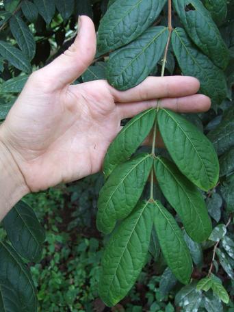
The indigenous approach to land and resource management differs in a few fundamental ways from those existing and promoted by the western world. Briefly, I will highlight a few significant advantages to the indigenous technique: In terms of both plant and animal populations they were far more diverse, by hundreds, if not thousands of times. Organization and complexity, the basic foundation behind the design of diverse agroforestry systems, mimics the composition of “natural” forest landscapes. Built forests are constructed on multiple “dimensions”, or levels; potentially incorporated are vines, shrubs, groundcovers, shade loving and full sun plants, bush fruits, hardwoods, crown bearers, and so on. All propagated plant species are intermixed with one another as they would be found in a mature forest; together they function in one large multi-lateral symbioses, or alliance. Although the established complex agroforestry system does not depend upon the human being, the human can interact in harvest, maintenance and propagation; through selective propagation one obtains superior genetics enhancing growth-rates and productivity.

Whitmore and Turner emphasize the many different patchworks of agricultural microsystems within built landscapes, in which “each elevation zone was attuned to small-scale environmental variation, furthering the ability to cultivate a wider diversity of products.” Through the implementation and mastery of this type of food/resource production model indigenous societies did not fail, as Europeans already had (at the time of the conquest), in producing ample food for dense populations while simultaneously maintaining a diversity of biological organisms and local ecosystems.


McNeely (2004) draws some conclusions concerning dominant patterns in the history of forests and biodiversity, which can be summarized as follows: The most significant fact to consider is that human beings have always been a dominant force in the evolution of today’s forests. Historically technological development and forest degradation have existed in a corollary relationship with one another – as technology becomes more and more sophisticated forests undergo a greater degree of modification and/or destruction.  As overexploitation continues and resources dwindle, forest degradation becomes increasingly detrimental to human populations eventually leading to a forced cultural change which is manifested through a reduction of human pressure. Such changes in conditions will either result in regeneration of forests to highly productive and diverse systems, or it will result in permanently altered, less diverse and less productive landscapes. Historical and contemporary examples suggest that the best approach to conserving forests and their biodiversity is through a variety of management approaches ranging from strict protection to intensive use (McNeely 2004).

Based on the relationship between modern societies and forest ecosystems, the idea of “intensive use” conjures up images of abuse and eventual destruction; razing of forest and installation of industrial or commercial fixture. This is where we must begin to reevaluate alternative possibilities and methods of land use and management. Managing agroforestry systems to address biodiversity concerns will both enhance productivity and contribute to conservation objectives. Intensive use doesn’t necessarily have to imply abuse.

One of the major issues concerning contemporary methods of tropical forest utilization derives from the fact that modern forestry practices originated in Europe several hundred years ago and were developed for the purpose of managing temperate ecosystems with relatively few species on resilient mineral soils (Plotkin, 2003). Notwithstanding the many structural differences between temperate and tropical forests, European forestry methods have been encouraged in tropical regions of the world almost exclusively for the removal of timber. Timber extraction today requires the use of heavy machinery which causes great damage to fragile tropical soils, and, consequent to the great harm inflicted through the process of timber extraction, tropical forests have been utilized as nonrenewable resources, usually turned into crop or pasture land that serves only for a few years before it is totally depleted.

How can tropical forests be utilized for their many renewable resources in ways that will still generate some sort of economic return without causing disastrous outcomes? One relatively obvious solution would be to focus more attention on the many non-timber products occurring within tropical ecosystems, such as foods, medicines, oils, waxes, fibers, latexes, tannins, dyes, resins, natural pesticides, spices, and other non-wood products (Plotkin, 2003).

The most logical approach towards the realization of the potential value in non-timber products is through the science of ethnobotany, which includes the investigation and evaluation of the knowledge of all phases of plant life among primitive societies and of the effects of the vegetal environment upon the life, customs, beliefs, and histories of these peoples. Ethnobotany studies the “totality of the place of plants in a culture and the direct interaction by the people with the plants”, offering an effective approach to the conservation of tropical forests through the expansion of our comprehension of the value in tropical forests beyond mere hardwoods (Ford, 1987). With this expanded knowledge commodities might be extracted with minimal ecological damage while simultaneously providing incentive for the conservation and rational utilization of tropical forests (Plotkin, 2003).

The agroecological approach encompassed by the practice of complex agroforestry offers a practical method of managing forests and restoring agriculture lands that have been degraded through the abuse of modern agricultural systems. As history has proven, through proper design and management techniques, rainforests and other terrestrial environments can potentially sustain large, dense populations, intensive cultivation and environmental protection without suffering from depletion and eventual destruction. The adoption and reintegration of traditional methods into our modern infrastructure would introduce and encourage resource management practices that are not only productive and environmentally sound but could actually help to enhance and improve ecosystems and biodiversity.

— Spencer Woodard (2007)

The Waru-Waru raised-bed agricultural systems of Los Llanos de Moxos, Bolivia

Note: Following are some sections I’ve extracted from a research paper I wrote some years ago, in 2006. This article should be read in conjunction with one I posted previously on the pre-Colombian chinampa raised bed hydrological agriculture systems.

 Waru-waru and the Domesticated Landscapes of Los Llanos de Moxos, Bolivia

Most of the lowland savannas in South America are seasonally inundated by overflowing rivers or standing rainwater. In the sense that there is a consistent source of water, these regions share some similarities with the lake basins and floodplains on which Mexico’s chinampas were constructed. One major difference is that whereas the chinampas in Valley of Mexico were endowed with perpetual spring-fed water, the raised-bed systems in lowland regions of Amazonia receive water once annually over the period of a long wet season.

The Beni savannas of Bolivia, Los Llanos de Moxos, provide another example of raised-bed wetland agriculture. This is a flat geographic region located at the southwestern headwaters of the Amazonian drainage basin and composed of very poor clay-pan soils low in organic matter, due to infertility there is little attempt to cultivate the region today. Nevertheless, aboriginal people in the Llanos de Moxos did cultivate the savanna, as is evident from the remnants of tens of thousands of ridges, drainage ditches, and raised platforms which provide ground above water and navigational canals for when the savannas were annually inundated  (Denevan, 1966b: 84-96). Not only is there ample evidence that these large, flat expanses were cultivated, but such practices were implemented on an intensive, year-round basis for thousands of years. A growing number of researchers believe the Beni once housed “some of the densest populations and the most elaborate cultures in the Amazon” (Mann 2000; Denevan 2001; Erickson 2001, 2006).

Up until recently the artificial earthworks and drainage features of the Llanos de Moxos had only been mentioned briefly. Oil explorations between 1958 and 1961 made available the first aerial photographs of the Moxo savanna, revealing the great extent and complexity of abandoned raised bed hydrological agriculture systems. These initial photos provided sufficient interest to spur on further investigation leading to more accurate estimations regarding the size, number and diversity of raised beds, causeways, irrigation canals and other landscape features (Plafker 1963; Denevan 1963).

Denevan (1966) was the first to provide detailed archaeological evidence that Palaeo-Indians made large-scale changes to the topography of much of the region, which allowed human habitation and food cultivation above the floodwaters. Denevan (1966) concluded that the basic vegetation patterns in the Llanos de Moxos savannahs have been determined by the degree of flooding, which is determined by local relief, but, perhaps most importantly he demonstrated that much of this relief was created by earthmoving activities of the pre-Hispanic peoples of the region. These populations permanently transformed regional ecosystems, creating what Clark Erickson ( 2005) has referred to as a “richly patterned and humanized landscape… one of the most remarkable human achievements on the continent”.

Some of the major elements that can be found in the artificial landscapes of the Beni include causeways, mounds of varying dimensions, a range of types and sizes of raised fields, canals, fish weirs, and circular ditches or moats. Abandoned remains are numerous and can be found throughout the Mojo savanna (Denevan 2001: 23-24; Erickson 2001: 23-25). The chronology for these various earthworks is limited, what evidence has been found indicates that that these societies have worked at modifying and maintaining their landscapes for at least the past three thousand years. All of these various forms of landscape engineering are indications that Moxos savannahs supported intensive fishing and farming industries, supplying, and maintained by, a much larger human population then that which exists in this part of Bolivia today (Maylle et al. 2006).

Clark Erickson has written that, beginning 3000 to 5000 years ago, cultures of the Beni savanna “erected thousands of linear kilometers of artificial earthen causeways and canals, large urban settlements, and intensive farming systems.” Originally Denevan estimated from aerial photographs that the raised field, canals and other earthworks of the region are estimated to cover an area of 77,000 square kilometers of land (Denevan 1966). However, based on more recent findings from ground surveys and enhanced satellite imagery, Erickson suggests that anthropogenic landforms cover a much larger area, demonstrating many raise fields are either under dense tree canopy or apparent only in faint traces often undetectable with the naked eye (Erickson, unpublished article).

Recent research from a variety of disciplines has steadily accumulated revealing more details and an altogether greater understanding of the Moxo savanna earthworks. The agricultural fields, or platforms, can vary greatly in terms of dimensionality but for the most part they were elongate and rectangular in shape, spaced anywhere from ten to a hundred feet apart and ranging from one to twenty five meters in width. Some of the larger fields extend to over three hundred meters in length. Smaller raised platforms typically occur in groups between several hundred and several thousand individual, sometimes interconnected, bodies. Interestingly while some fields are in parallel alignments, others angle off obliquely. These varying features have been interpreted as relating to the direction of natural flow of the water, or to unknown customs regarding sacred alignments. All in all there are tens of thousands of raise fields extending across the vast, flat landscape, highly indicative of large, well-organized populations (Denevan 1966: 85).

Circular mounds (lomas) are also common through the area, especially within peripheral gallery forests. The mounds have been variously interpreted as garbage piles, house mounds, ceremonial mounds or burial mounds. Linear ridges serving as causeways often radiate from mound sites, often connect mounds and forest islands. Based on the centrality of the mounds it is likely that they served as settlements, inhabited by up to a few thousand people. Judging by the overarching logic and intelligence behind the greater system it is unlikely that the populations produced and accumulated waste, as is typical of western cultures. Instead it appears as if waste was synonymous with building materials, fertilizers and other structural components. The composition of raised beds, causeways and fish weirs suggest that primarily “trash” served as a vital construction material (Erickson 2005: 235-267).

The causeways, which have been said to be one of the most spectacular features of Moxo landscapes, are thought to have performed multiple functions, for transportation, hydraulic control and as boundary markers. Major canals flanking either side of the causeways were most likely built both for transportation purposes and to regulate water levels within the system, diverting water to and from streams and rivers.  Other highly impressive earthworks discoveries are the many complex networks of linear zigzag structures that have been interpreted by Clark Erickson (2000) to have functioned both as levees and fish weirs, used seasonally to capture and contain both water and edible water fauna. Erickson has conducted the most extensive archeological studies in the area and conclusively interprets all major features of the landscape as anthropogenic due to their “unnatural” shapes and because they have been found to be constructed from an assortment of materials not typically found in the area, including rock, ceramic, sticks and basketry (Maylle et al. 2006).

When were these landscapes constructed? How long were they were used?  When were they abandoned? As of yet, none of these questions have been adequately answered, or empirically proven. Although, in regards to the latter question, as with the chinampas of Mexico, it is widely believed that the Conquest played a staring role in the demise and desertion of Moxo settlements. The Beni region of Bolivia was one of the last to be invaded and conquered. Local Indian populations were successful in building a reputation of ferocity thus deterring the European enemy for a time. There are a number of theories: one is that the extensive systems were preemptively abandoned in expectation of the imminent onslaught of ravenous Europeans. Under these circumstances it is thought that the many interconnected villages and societies would have necessarily fragmented, migrating to surrounding areas. Another possibility is that illnesses was brought to the continent by the Europeans, such as smallpox, which may have arrived to the Beni region before the Europeans did, effectively eliminating sufficient numbers of people to force abandonment. Interesting is the detail that the Beni savanna was pegged for a longtime as being a potential location of the fabled city of El Dorado. It is said that when the Spanish finally arrived to the region, upon seeing no golden paradise they promptly left, not to return for another few hundred years when in search of oil deposits (Mann 2000).

Chinampa: Pre-Colombian raised-bed hydrological agriculture

Note: Following is a paper I wrote years ago (2006), when I first became interested in the history, evolution, and eventual Spanish-inflicted decline of Aztec Chinampa agriculture. The essay draws from much of the past and present research devoted to understanding these systems. It is the first part of a two part paper. The second part concerns the raised – bed / canal systems of Los Llanos de Moxo, Bolivia.

Please feel free to contact me with any questions / additional info at spencer (dot) woodard (at) gmail (dot) com

Chinampa: Raised-bed hydrological agriculture

By Spencer Woodard

“And when we saw all those cities and villages built in the water and other great towns on dry land, and that straight and level causeway leading to Tenochtitlan, we were amazed…Indeed, some of our soldiers asked if it was not all a dream” (Spanish chronicler, Bernal Diaz del Castillo)

“There is little doubt that the chinampas just south of Mexico City represent the most sophisticated version of Mesoamerican swamp agriculture. The complexes are extensive and most are strictly rectilinear, oriented roughly in accord with the sacred direction of Teotihuacan. The hydrology of the system has always had to be closely managed in order to prevent flooding, as well as to introduce sufficient fresh water to maintain levels and a slight flow in the canals. Production is year round and finely tuned. All in all, this is an engaging garden landscape or, rather, it was until mechanized commercial cultivation and suburbanization led to the obliteration of many chinampas” (Siemens 1980).

Adaptive systems involve careful planning, implementation and organization but offer the most logical approach to effective biodiversity conservation within food and resource producing systems. The raised-bed hydrological agricultural systems of antiquity offer an example of adaptive land management.

Chinampa describes a system, or network, of raised fields on low man-made islands in the middle of lakes, marshes and floodplains. Currently, the most intact, refined examples of chinampa agriculture can be found in the Xochimilco/Chaleco lake basins in the central valley of Mexico. Looking further, we find that similar land management techniques have been employed throughout the Americas. Another one of the more impressive and extensive examples can be found in Los Llanos de Moxos, in the Beni region of Bolivia. In the following pages, I will explore the importance of these sites as working examples of sustainable human living systems.

The examples of traditional raised-bed agricultural fields, such as those in Mexico and Bolivia, are widely regarded as the most productive and ecologically sustainable forms of agriculture in pre-Hispanic Mesoamerica (Chapin 1988).  “In a very real sense, chinampa agriculture has represented a self-contained and self-sustaining system that has operated for centuries as one of the most intensive and productive ever devised by man” (Chapin: 9).  It has been generally concluded that the level of technology reached in agriculture during this time was rarely equaled anywhere else in the world at the time. The use of human labor, hydraulic technological sophistication and administrative complexity were correspondingly high (Parsons, 1991; Torres-Lima et al. 1994).

In light of the current human-induced pandemic of global destruction, the theory and practice behind chinampa hydrological agricultural systems may become increasingly important for the conservation of agro-biodiversity and as a means for humans to adapt agricultural production to cope with volatile changes in global climates and weather patterns. The dwindling chinampero culture represents one of the few remaining groups of humans on earth who hold the knowledge and technique to build, cultivate, and maintain this highly restorative, productive and sustainable agriculture technology.

There exists a common misconception, that the Aztecs invented chinampa technology, in fact they did not. Although it has been widely recognized that societies of the late Aztec period developed the most sophisticated models, it is now clear that Chinampas were employed long before by lowland Maya. The chinampas of Chaleco and Xochimilco were inherited by the Aztecs through the expansion of the empire and domination of the regional indigenous population, the Xochimilicans. Indeed, archeological evidence suggests that throughout Mesoamerican prehistory raised-bed agricultural system use has been extensive and widespread, adapted to a diverse variety of climates and landscapes. (Leon-Portilla, 1992; Torres-Lima et al. 1994).

The Xochimilcas established themselves at the foot of the Cuauhtzin Hills of Mt. Ajusco on a peninsula that juts into Lake Xochimilo. All of their structures were made out of materials derived from the lake. As their numbers expanded the Xochimilcans began to create land on top of the lake basin wetlands by building up rectangles of vegetation (tulle reeds) layered with, organic matter and mud, excavated from the lake bottom. The resulting raised platform and water canal network functioned perfectly with gravity providing for adaptation to a wide range of weather patterns. Eventually thousands of artificial interconnected islands were constructed. It is thought that the city of Chaleco was originally settled by Chelmeca Indians, who practiced the same chinampa building techniques. The two cities resisted Aztec domination for over two hundred years. Finally, around the middle of the fifteenth century they submitted to Aztec rule. Despite the change in government, the two cities remained intact, expanding throughout the duration (Torres-Lima et al. 1994)


There is little doubt among experts that the human population residing within the valley of Mexico had easily topped one and a half million by the time of the Conquest. The Aztec capital of Tenochtitlan is thought to have supported a population of up to  three – hundred thousand people, which would have been around five times the size of King Henry’s London at the time. The immediate suburbs of Tenochtitlan are thought to have contained another 200,000 humans and, in addition, well over a million resided in the greater surrounding area including the greater 3,000 square mile central valley of Mexico. It is widely surmised that the majority of food stuffs consumed by this population came largely from the extensive, 1,200 square kilometer chinampa raised-bed and canals network built as inter-communal hydrological and agricultural infrastructure (Redclift 1987; Chapin 1988: 10; Outerbridge 1987; Garavaglia 1992: 572-573).

Descriptions of the Capital by the first Spanish conquistador/chroniclers baffle the mind for we can only barely comprehend such a human living environment:

It was bigger than Paris, Europe’s greatest metropolis. The Spanish gawped like yokels at the wide streets, ornately carved buildings and markets bright with goods from hundreds of miles away. Boats flitted like butterflies around the three grand causeways that linked Tenochitlan to the mainland. Long aqueducts conveyed water from the distant mountains across the lake and into the city. Even more astounding than the great temples and immense banners and colorful promenades were the botanical gardens – none existed in Europe (Mann 2006)

The first hand account of Francisco Lopez de Gomara (1553) describes the Aztec capital as a city…

…built on water, exactly like Venice. The whole body of the city is in water. The wide and pleasant streets are of three kinds. Some consist entirely of water with a great many bridges, others are completely solid, and a third type combines solid and water, with people walking on the dry half and using boats on the other half… Almost all houses have two doors: One leading to the pavement and the other to the water on which they travel by boat.


It has been estimated that 10,000 hectares of chinampa fields, under intensive cultivation, would have been sufficient to supply at least half a million people with basic food staples (Torres-Lima et al. 1994: 39). The Chalco/Xochimilco site is situated in an endorphaic lake basin at an altitude of over 2,240 meters and surrounded by a high mountain range whose highest peak reaches 5,452 meters. Within this region there is evidence that over twelve thousand hectares, or 120 km sq. of land, was reclaimed in the shallow areas of the lakebed and transformed into a chinampa network yielding around 9000 agriculturally viable hectares, all within an ingeniously irrigated and navigable hydrological aqua/agricultural system (Armillas 1971; Arco & Abrams; Torres-Lima et al. 1994).

Because the productivity of chinampa fields increased with the physical expansion of the system Tenochtitlan deliberately made the commitment to large-scale wetland reclamation so as to secure a subsistence base through this highly productive and accessible agricultural method, which had potential for expansion as long as there was space available (Arco & Abrams; Parsons 1991).

As a result of massive depopulation after the arrival of the Europeans, due to disease, slavery, massacre, missionization, resettlement and war, the vast majority of indigenous inhabitants who had previously played a central role in the structure, composition and day-to-day management of the landscape were eliminated. The Spanish are reported to have been single-handedly responsible for the destruction of these vast and impressive landscapes. In one especially destructive incident, stones were stolen from the massive Nezahuacoyotl dike so that the Spanish could erect their obscene and comparatively rudimentary and inferior colonial cities upon and around the ruins of Tenochtitlan, a site we know today as Mexico City. After the Spanish invasion and the destruction inflicted upon the chinampa systems at Tenochitlan, the spring fed lakes of Xochimilco and Chaleco were steadily depleted. By the end of the 17th century the Indigenous population of the valley of Mexico had plummeted from 1.5-2 million just before the conquest to 70,000 not much more than a hundred years later (Outerbridge 1987; Redclift 1987; Chapin 1988; Barra 1996).

The Tenango and Tlalmanalco rivers, which for millennia had supported the fresh water supply to Lake Chaleco, were diverted and springs were tapped, leaving the lake dry by 1900. Without the time tested and highly effective chinampa network in place, devastating floods would periodically haunt the city. Lacking the experience and adaptive capacity of the Aztecs who had logically and effectively controlled the water for thousands of years, the Spanish tried to get rid of it altogether, digging huge ditches and draining the vast lakes which would ultimately worsen the problem and lead to wind storms of noxious ground salts from the saline lake bottoms, which persists today as Mexico city’s worse natural scourge (Torres-Lima et al. Chapin 1988; 1994; Mann 2006).

The incessant expansion of contemporary Mexico City has not acted kindly upon the chinamperia. At the beginning of the nineteen hundreds the Porfista government decided upon what they thought would be a viable solution to the ever-present problem of insufficient supply of potable water supply. The city would pump water from Xochimilco’s large springs, which for centuries had generated water supply for the chinamperia. Nativas spring, the largest at Xochimilco, would be pumped at two cubic meters a second and the city’s ravenous thirst would be quenched. The project was executed within eight years in which time Mexico City had grown thus demanding more. Additional pumps had to be installed, increasingly bigger and more powerful, until all major springs to Xochimilco were tapped and the lake began to dry up. All of the smaller, peripheral chinampas suffered from the dwindling availability of water due to their slightly higher elevations, canals dried up making irrigation difficult, if not impossible, and the productivity of soil plummeted the surviving generation of chinamperos were forced to sell their property to housing developers and the like. When the outcry of displaced populations and destroyed agriculture technologies were heard by the Mexican government it was agreed that the pumping would be reduced by a little bit and that the city would grant Xochimilicans with the city’s semi-treated black-water sewage. Eventually the city began to suck straight from the groundwater surrounding and directly supplying the chinamperia causing it to sink, “like a dry sponge, the subsoil is compacting and the chinampas are sinking” (Outerbridge 1987: 80-82). By 1988 half of the chinampa’s remaining 2,300 hectares were actively farmed, the rest had been destroyed; consumed by the encroaching sprawl of the great metropolis. Today only two hundred hectares remain and not all of them are in production. What does remain is largely put to use for somewhat disheartening purposes: a place where tourists come to be polled about in the canals underneath the canopy of a brightly painted boat; a place where underpaid laborers are put to work toiling in the fields to grow ornamental flowers to satiate the whimsical desires of wealthy, ornamental flower-buying people; and, finally, as a place for the city to dump its trash and human waste (Outerbridge 1987: 82-83; Torres-Lima 1994).

~

The word “chinampa” is thought to have been derived from the Nauhatl words chinamitl, meaning “reed basket,” and pan, meaning “upon.” The etymology aptly describes the basic idea of chinampa construction, which was traditionally executed by way of piling bed-clay and mud from the lakes, aquatic plants, dry-crop silage, manure and silted muck upon one another in precise layers between paralleled reed fences anchored in the lake bottom. The material used in constructing the raised platforms is excavated so as to create narrow canals which divide elevated areas. The result was a highly ornate, intricate and accessible system.

The historically sustainable components of the chinampa agriculture, as summarized from conclusions drawn by Torres-Lima et al. (1994), are as follows: 1) by conserving renewable resources and reducing environmental impacts, the farmers efficiently managed the lake habitat for agricultural purposes; 2) through recycling practices, they maintained nutrient flow and wastes cycles; 3) by conserving a high degree of biodiversity in time and space, they efficiently used the resource base, increased biological interdependence between crops and pests, and  reduced crop failure; 4) to intensify the production and increase sustainable levels of productivity, the farmers relied on regional resources, efficient use of labor, and high technological complexity; 5) by using social and economic factors in decision-making, diversification of crops and maximization of returns were part of the development of self-sufficiency and economic viability of the chinampa system (Torres-Lima et al. 1994: 39).


The southern lake chinampa system of Mexico used an enormous numbers of intricate drainage canals, or zanjas, as well as the chinampa fields and canals. The fields and drainage canals, when aligned and cross-sectioned, form small islands, typically long and narrow ranging in lengths between six and nine meters (Wilken et al. 1969: 223; Armillas 1971: 653; Arco & Abrams 2006). The general layout of fields and canals consisted of long fingers of solid ground, which alternated with navigable waterways, resulting in a tight, intricate configuration. The raised platforms were typically narrow and rectangular in shape. It has been reported that beds traditionally measured 2 to 4 m wide and 20 to 40 m long, surrounded on three or four sides by canals (Torres-Lima et al. 1994: 38-49). Armillas (1971) reports dimensions of 2.5-10 meters wide and up to 100 meters long. The raised portions were usually built by alternating layers of mud scraped from the lake or surrounding swamps and thick mats of decaying vegetation over shallow lake bottoms or in marshy zones. Platforms rose up to a height of 0.5-0.7 meters above the water level, the sides reinforced with posts interwoven with branches. Willow trees were traditionally planted along the edges providing anchor and structural support. The depth of the canals varied, ranging from one to one-and-a-third meters (Armillas 1971; Torres-Lima et al. 1994).

Prutzman (1988) delineates the essential steps in chinampa construction.  First, chinamperos use a long pole to find an adequate base for a chinampa and when possible uses a cimiento, the remains of an old chinampa, as the foundation for a new one.  Next, strong reeds are “stuck” in the bottom to mark the base dimensions.  Then mud is excavated from around the base and piled atop the reeds and cimiento.  Mats of water vegetation are then cut and transported to the new chinampa.  These dense vegetative mats, or cesped, were primarily made from water lily and tule reeds. A nutrient-rich compost heap is created by layering mats of vegetation to form a thick cap.  Mud from the bottom of the lake is mixed with soil from an old chinampa and placed on top reaching a height of about one foot above the water level.  A porous base, rich in organic matter, is created through which water easily flows and irrigates through capillary action  Lastly, the sides secured with woven reeds, and then willow trees, Salix bomplandiana, are (traditionally) planted around the edges.


An alternative view of chinampa construction is presented by Wilken (1985) who suggests that aquatic plants have no structural role in chinampas; rather, he believes that plots are constructed by “simply extending drainage canals out into swamps or shallow lakes or back into low-lying shores” and then piling the excavated material onto spaces between the canals.  While the dredged mud inevitably contains aquatic plants, Wilken maintains that these plants are not important structural component (Wilken 1985). It would seem to me that aquatic plants would be a very important in defining structure on multiple levels. As aquatic plants decompose and turn into earth they serve to maintain overall mass of the raised bed in addition to augmenting the nutritional structure, or content, of the soil. The soil fertility of the raised bed is continuously renewed by scooping up and applying sediments and mud from the bottom of the waterway onto the raised fields, water plants cultivated on the surface of the waterways are intermittently layered with dredged material.


Benefits of the chinampa system are significantly amplified when the fields are tree-lined. Once mature and fully leaved, the trees create a canopy which serves a variety of crucial functions. Trees anchor the beds, creating a boundary and infrastructure. As trees grow larger their fruit and foliage drop off onto the beds and in the water where they function as mulch, or into the water where they decompose and turn into nutrients, or they are eaten by aquaculture species such as prawns, fish, turtles, caiman, and so forth. Planting trees helps enable microclimates; trees both block the wind and hold air in and underneath the canopy which achieves a higher temperatures and humidity levels thus greatly reducing, if not eliminating, frost damage and crop failure that would other wise occur in exposed areas (Arco & Abrams 2006). “Creating channels of warmer air, the morphology of raised fields and associated canals can raise air temperatures as much as 6.3 degrees Celsius above that of dry fields.” (Crossley 1999: 280)  

Chinampas also regulate micro-climates by moving and retaining moisture through capillary action (between layers of soil and organic matter), the system promotes the cycle of nutrients between compartments. The result is living soil, with its own respiratory and circulatory functioning. Chinampas are also high in microbial organisms, both in the earth and water, which promote high yields of terrestrial and aquatic plants by continuous cropping and utilization of the diversity of niches.

Ingenious seed germination beds and seedling nurseries were employed in the chinampa system by the Aztecs, the Maya, and, most likely, Mayan predecessors. At the edge of the chinampa bed, at the water’s edge, low terraces are formed. These perpetually moist and humid environments, called “almacigas”, are filled and maintained with ultra-nutritious sludge scooped from the bottom of the chinampa canal with a customized long-handled pole basket called the “zoquimaitl”, seeds are germinated and cared for in these customized environments. “These seedbeds with their concomitant protective and growth promoting mechanisms are the real core of chinampa agriculture. Without them this type of cultivation could function no more effectively than any other kind” (Outerbridge 1987: 80).

Coe (1964) provides details of this practice: At one end of the chinampa near a canal the almaciga is made by spreading a thick layer of mud over a bed of waterweeds.  After several days, when the mud is hard enough, it is cut into little rectangular blocks called chapines.  The chinampero makes a hole in each chapine with a finger or a stick, drops in the seed or cutting and covers it with either human or livestock manure.  For protection against the occasional winter frosts the seedbed is covered with reeds or old newspapers, however the introduction of trees along the perimeters or within the beds is an effective method to create microclimate underneath the canopy, raising the temperature and humidity, thus avoiding frosts. During dry weather the sprouting plants are watered by hand.  Once the plant is ready to be transplanted a cube is cut around each small seedling which is then directly placed in its designated place, which has been preconditioned with canal mud and a thick mulch of water plants (Coe 1964).

The highly logical and strategic placement of the almaciga is superior to the conventional centralized nursery system for a few reasons: For one, as mentioned, it maintains its own moisture and humidity, even during drought it is in close proximity to a water source, reducing labor input in the wasteful, time-consuming task of irrigating a large nursery area; plants are propagated exactly where they will be transplanted, maintained and eventually harvested, this greatly cuts back on unnecessary and inefficient transportation and transplants required by a centralized nursery; in addition you are able to mass propagate without using pots, bags and plastic containers; an additional benefit is that plants are germinated in the same soil that they will be transplanted to, this results in heightened rates of growth and productivity, the plant will be better adapted to the soil type. Another point is that the nutrient content of the canal water used for irrigation is far more complete and consistent in composition than any human-fabricated organic or chemical fertilizer.

The chinampa system is not only highly productive in terms of the rate and amount of production per land area and per inputs, but also sustainable in the sense of continuous long-term, year-round productivity. Facing a variety of constraints such as hydrological and climactic factors in addition to increasing demand for food, Aztec chinamperos successfully reached an equilibrium between sustained yields and ecological and management factors (Redclift 1987; Torres-Lima et al. 1994). Interestingly, Berres (2000) reports on how chinampa canals were not simply smaller versions of the lake on which they were constructed, including similar numbers and distributions of species and habitats, chinampa canals have actually been found to be more productive with heightened levels of biodiversity due to the creation of a wide variety of micro-environments (Berres 2000).

Chinampas in the news - Mexico

Here is an interesting article about the current state of Mexico’s chinampas. For more articles on Chinampas and related agriculture / land management systems from this site search “chinampa” in the right-hand side bar (or click link). Here is a link to the original article quoted below.

Mexico’s Chinampas – Wetlands Turned into Gardens – Fight Extinction

By Emilio Godoy

Edited by Estrella Gutiérrez/Translated by Stephanie Wildes

Chinampa 1.gif

A farmer transports his freshly harvested crops from his chinampa – a rectangular garden on land reclaimed from the wetlands of Mexico City – along a canal in Xochimilco. But this age-old Aztec technique used to feed the local population is threatened by the encroaching city and by pollution. Credit: Emilio Godoy/IPS

XOCHIMILCO, Mexico , Feb 27 2016 (IPS) – David Jiménez grows two kinds of lettuce and other fresh produce on his “chinampa” or artificial island just under one hectare in size in San Gregorio Atlapulco, on the south side of Mexico City.

“We can get five or six harvests a year. Lettuce can grow in 30 days,” Jiménez, the president of the six-member La Casa de la Chinampa cooperative, told IPS with evident enthusiasm. The cooperative operates in Xochimilco, one of Mexico City’s 16 boroughs.

The ejido – land held in common by the inhabitants of a village and farmed cooperatively or individually – where Jiménez has his farm covers 800 hectares, and is home to 800 farmers who mainly grow vegetables. Half of the ejido is made up of chinampas.

The system of chinampas dates back to the Aztecs, long before the arrival of the Spanish conquistadors in the 15th century. The technique creates small, rectangular gardens reclaimed from Mexico City’s marshy lakebed by piling up soil on a mat of sticks, using wattle as fencing and willow trees at the corners to secure the bed.

The chinampas are rich in muck and decaying vegetation, which provide nutrients for the crops, while the ditches between them give the plants continuous access to water. As a result, the vegetables grown there are especially rich in nutrients.

The chinampas, which help feed the 21 million people who live in Greater Mexico City, are in the boroughs of Milpa Alta, Tláhuac and Xochimilco.

Worked by some 5,000 farmers, the chinampas cover a total of 750 hectares. The system is profitable, because they produce a combined total of around 80 tons a day of vegetables.

Each head of lettuce fetches 10 cents of a dollar, Jiménez said, as he tended to a row of lettuce.

The chinampas or “floating gardens” produce spinach, chard, radishes, parsley, coriander, cauliflower, celery, mint, chives, rosemary, lettuce and purslane or pigweed. Visitors to the area walk along paths that take them across a green carpet segmented into rectangles of crops and divided by the ditches of water they depend on to grow.

The drought-resistant system uses less water than traditional irrigation and produces fish, vegetables, flowers and medicinal herbs.

Studies also show that the chinampas repel pests, are more productive than conventional agricultural systems, and produce biomass. The technique is completely sustainable, retaining moisture and regulating the microclimate in the area.


David Jiménez, a local farmer, next to medicinal herbs grown on his land in San Gregorio de Atlapulco in the Mexico City borough of Xochimilco, where chinampas continue to survive – an age-old Aztec technique that creates farmland out of the local wetlands. Credit: Emilio Godoy/IPS

Ricardo Rodríguez, founder and director of the company De la Chinampa a tu Mesa (“from the chinampa to your table”), came up with a way to link traditional production techniques with new technologies, by marketing the vegetables grown on the chinampas over social networks.

He picks up fresh produce in the Cuemanco natural area in Xochimilco, signs up customers on his web page, processes the purchases, and distributes the orders to the customers’ homes.

“We help generate demand, which motivates them to keep farming. And this helps restore the chinampas. The market is starting to recognise the value of the chinampas,” Rodríguez told IPS.

The entrepreneur works with 22 “chinamperos” or chinampa farmers who grow broccoli, spinach, beets, radishes and other crops on approximately 15 hectares. He delivers some eight orders a day, weighing eight kg on average. His 450 registered customers include stores and restaurants that sell organic food.

Xochimilco, which is home to more than 415,000 people on some 125 sq km, was named a World Heritage Site by the United Nations Educational, Scientific and Cultural Organisation (UNESCO) in 1987.

In addition, the Ejidos de Xochimilco and San Gregorio Atlapulco Lake System have been on the Ramsar ConventionList of Wetlands of International Importance since 2004.

The U.N. Food and Agriculture Organisation (FAO) selected the chinampas as a Globally Important Agricultural Heritage System (GIAHS), because they preserve agricultural biodiversity, help farmers adapt to climate change, bolster food security and reduce poverty.

Marco Covarrubias, the head of the Gastronomy Centre at the private Claustro de Sor Juana University based in Mexico City, stresses the importance of the chinampas in terms of food production.

“The advantage is that they are in permanent contact with water, which unlike in other systems is not used to irrigate but is absorbed by the plants,” he told IPS. “And they have added nutritional value because a large part of the chinampas is free of pesticides and other agrochemicals.”

Urban sprawl and expanding slums, the use of pesticides, climate change, excessive use of groundwater, and neglect have all contributed to the destruction of the chinampas, says a study by the Natural and Cultural Heritage of Humanity Zone Authority (AZP) in Xochimilco, Tláhuac and Milpa Alta.

The AZP, created in 2014, is in charge of managing the preservation of this special ecosystem, in order to maintain the UNESCO and Ramsar Convention designations.

“Any effort to protect the area must take into account the local farmers and the cultural environment surrounding the chinampas. This is a culture that is not really appreciated, the restoration plans haven’t been carried out,” said Jiménez.

His cooperative decided to create a model farm on two hectares of their land, to show visitors the benefits of the chinampas.

And on Feb. 22, it launched a programme in local schools, which includes a virtual tour of the chinampas. With some 6,400 dollars in public funds, the idea is to raise awareness among 6,000 students in primary and secondary schools in Xochimilco.

The environmental authority is facing cuts, which have hurt its efforts to protect the region. Its budget shrank from 700,000 dollars in 2015 to 400,000 dollars this year. Since 2013, the AZP has supported 174 environmental and cultural improvement projects, but there is no clear information about the specific impact on the chinampas.

In March 2014, the French Global Environment Facility donated 1.65 million dollars for the conservation of the area.

In an October 2014 report, “Rehabilitation of the chinampera network and the Xochimilco native species habitat,” the Biology Institute of the National Autonomous University of Mexico said restoration of the chinampas should be a priority, because of their ecological, economic and social importance.

It recommended promoting the concept of chinampa-nature reserve, “because this represents multiple benefits for improving water conditions while giving a boost to sustainable productive activities as a strategy to prevent encroachment by urban sprawl.”

Covarrubias, meanwhile, said “Greater attention should be paid to the chinampera zone; it should be studied as an area of extremely high production potential, and a public policy should be created to link people who live in, and make a living from, the chinampas, with direct buyers.”

Since 2014, his university has organised the La Chinampería programme, to hook up local farmers and buyers. And this year it is carrying out another applied research plan to foment value chains, with the participation of 15 chinampa farmers.

“Awareness-raising programmes are needed for their descendants to start to recuperate the chinampas, improve the cleaning system, and acknowledge the farmers,” said Rodríguez, the entrepreneur, who organises “consciousness-raising tours” on the role of the chinampas in food security and the importance of small-scale local agriculture.

He wants to create a market of producers in Cuemanco, generate a label for goods produced in Xochimilco, to boost the prices of local products, and set up a collection centre for the products.

Edited by Estrella Gutiérrez/Translated by Stephanie Wildes

Mapping the first family tree for tropical forests

More than 100 researchers have collaborated to classify the world's tropical forests according to their evolutionary history, a process that will help researchers predict the resilience or susceptibility of different forests to global environmental changes.

The results, culled from almost 1 million different tree samples from 15,000 tree species, have uncovered a shared ancestry between tropical forests thousands of miles apart and previously believed to be unrelated. Published this week in the Proceedings of the National Academy of Sciences, the study describes an international, grassroots effort to collect and analyze data from more than 400 geographic coordinates across the tropics, a region that comprises 40 percent of the Earth's surface.

The study was led by Ferry Slik, an associate professor at the Universiti Brunei Darussalam in Brunei. Janet Franklin, a distinguished professor of biogeography at the University of California, Riverside, coordinated the interpretation and reporting of the data, which is publicly available as an open access article.

Franklin said the new classification scheme's value comes from the inclusion of ancestral information about the tree samples (gleaned from DNA analyses), rather than the "snapshot" of tree biodiversity that is obtained from recording a plant's species.

"When ecologists study biodiversity, they look at the present day by identifying the range of species in a particular forest. However, without going deeper into a plant's history by looking at its family tree, each species is considered separate and unrelated," Franklin said. "By adding the evolutionary relationships between species, however, we suddenly have a measure of how similar species are to each other. This means that we were able to do a much more detailed and realistic comparison between forest sites than previously possible."

The study revealed five major tropical forest regions: Indo-Pacific, Subtropical, African, American, and Dry Forests, which are found at the boundaries between tropical and dry climates.

The study also showed the evolutionary relationships between the forests. One surprising finding was that tropical forests in Africa and South America are closely related, with most of the differences between them occurring within the last 100 million years.

More information: J. W. Ferry Slik el al., "Phylogenetic classification of the world's tropical forests," PNAS (2018). www.pnas.org/cgi/doi/10.1073/pnas.1714977115 

Journal reference: Proceedings of the National Academy of Sciences  

Provided by: University of California - Riverside 

2,000 years ago, people domesticated these plants. Now they’re wild weeds. What happened?

"Adventurers and archaeologists have spent centuries searching for lost cities in the Americas. But over the past decade, they’ve started finding something else: lost farms.

Over 2,000 years ago in North America, indigenous people domesticated plants that are now part of our everyday diets, such as squashes and sunflowers. But they also bred crops that have since returned to the wild. These include erect knotweed (not to be confused with its invasive cousin, Asian knotweed), goosefoot, little barley, marsh elder, and maygrass. We haven’t simply lost a few plant strains: an entire cuisine with its own kinds of flavors and baked goods has simply disappeared.

By studying lost crops, archaeologists learn about everyday life in the ancient Woodland culture of the Americas, including how people ate plants that we call weeds today. But these plants also give us a window on social networks. Scientists can track the spread of cultivated seeds from one tiny settlement to the next in the vast region that would one day be known as the United States. This reveals which groups were connected culturally and how they formed alliances through food and farming."

Read full article at ArsTechnica: Hunting for the ancient lost farms of North America

Ebenaceae, Diospyros blancoi, velvet apple, mabolo

Mabolo, or velvet apple is an attractive tree, closely related to the persimmon and ebony.

As the English common name would suggest, the fruit is covered in a fine, velvety skin, usually reddish brown. Inside is a soft, creamy flesh with a unique taste and aroma. The species is native to the Philippines where the tree is referred to as kamagong. It is strictly a tropical tree, drought tolerant growing well in a wide variety of soils, from sea level to 2,400 feet. Planted from the seed the tree can take up to six years to bear fruit. Trees propagated from cuttings produce fruit in three to four years.


Eugenia stipitada - Araza

Thought to be native to the Peruvian and Brazilian Amazon, still not very widely cultivated. Araza is typically consumed fresh, used to prepare excellent juices. The flavor and texture is considered to be superior to the guava. The most notable benefits of this species are, A) that it is shade loving. Unlike most fruit trees, Araza prefers at least partial shade. I have seen it growing and producing fruit in the dappled shade of understory, below two canopies. B) Given the right conditions the tree can bear fruit within a year and a half or two years of growth. Once a tree begins bearing it can be depended up on to flower and fruit fairly consistently. C) Fruit are large, seeds are easy to separate. D) The fruit is versatile. Excellent as a base for sauces, juices, and so forth. Usually used for juices. Consumed with Miracle Fruit it is almost disgustingly sweet. Araza is extremely rich in carbohydrates (7%) and vitamin B1.

The tree thrives in humid tropical climates, adapted to at least 2,000 mm annual rainfall and to poor, acidic soils.

Myrciaria cauliflora - Jaboticaba

The Jaboticaba originated in Southern Brazil. In Rio de Janerio it is one of the most popular fruits, widely available in markets. It is not very widely cultivated outside its area of origin. The tree yields a fruit similar in size and shape to a grape, which is eaten raw, in sweets and marmalades, and used in the preparation of wine.    Nutrition: Jaboticaba is high in sugars and vitamin C.    

The Jaboticaba requires a cool, humid, subtropical climate for best growth and production, but it will not support freezing temperatures. Humidity is important for the production of fruit. The tree prefers deep, well drained soils, high in organic matter.  The tree is most commonly propagated from seed, needing six to eight years to produce fruit in a hot climate, 10 – 15 years in cooler climates. Aside from this inconvience, the jaboticaba is widely considered to be one of the best tropical fruit trees. A tree in full production can yield up to five harvests a year.

Eugenia uniflora - Suriname Cherry

Suriname Cherry originates in Brazil from Bahia to the south; along with jaboticaba, it is one of the most common fruits in the country.

In humid tropical climates the tree can surpass 7 m in height. In subtropical regions it typically doesn’t get much taller then 2-4 m.

The foliage is very decorative, bright green with various hues of red in new leaf growth.

The fruit has many uses, but is typically eaten raw. There exist red and purple varieties, which can be either sweet or acidic. It is considered to be one of the best Myrtaceae fruits. The tree bears abundantly, its fruits typically used in preserves, ice creams, syrups, wines and liquors.

The leaves of the tree emit a pleasant aroma when crushed, the smell is employed as a deterrent for flies and mosquitoes. To this end, it is Brazilian custom to scatter crushed leaves on the floors of ones home. The flowers attract honeybees, considered to be a desirable species for apiculture.

The fruit contains 6% sugar, 1% protein and is very acidic, and rich in vitamin C, 25 – 43 mg per 100 g.

Trees are adapted to the humid tropics and subtropics, from sea level up to 1,700 meters altitude, but they thrive in lower elevation, hot, humid tropical climates. In dryer regions the tree benefits from irrigation, which enables it to produce more abundantly. The tree can adapt to all kinds of soils, from sandy to clay.